Nature up close and personal
Hiking is a big attraction at Suikerbosrand, with day trails ranging from the 700m Toktokkie trail, accessible in wheelchairs, and the 4km Cheetah Trail to the more technical 10 km or 11.5 km Bokmakierie Trail, while overnight hikes that take up to 6 days to complete along a 66km network of trails, with basic huts to sleep in, can also be undertaken.
Day Trails
Toktokkie
Named after the "Toktokkie" beetle (Tnebrionidae family), this trail with its Braille interpretation, is specially developed for wheelchair access and visually impaired visitors and extends for 700 meters.


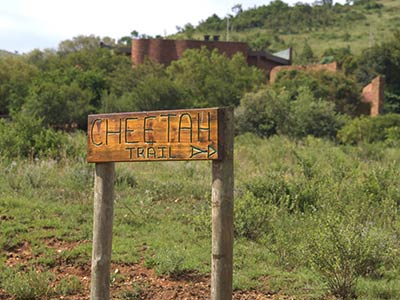
Cheetah Trail
Named after the cheetah that once roamed the reserve, the cheetah trail is a 3.7 km route suited to those looking for a shorter hike. The path is well marked with yellow and black markers depicting a running cheetah. The arrows indicate the direction of the route. At intervals along the trail you will come across these numbered markers which have been placed to draw your attention to items of interest
View Cheetah Day Trail MapAttention Runners
The reserve strives to keep trails safe and limit erotion; therefore running on either the hiking trails or the roads, is not permitted.
Suikerbosrand Nature Reserve is a public space that we all share - please be considerate of other visitors, the staff, plants, animals and the spirit of Suikerbosrand.

Bokmakierie
Named after the "Bokmakierie" (Telophorus zeylonus), the trail offers a choice between a 10 km and 11.5 km hike. Both trails have the same starting point. After approximately 6 km the trail splits. The 10 km route being to the right(green footprint); and the 11.5 km to the left (yellow footprint).
View Bokmakierie Trail MapUseful Info
Start early as the area can get hot at midday. Expect thunder storms accompanied by lightning between the months of October to March, in the afternoons .
A good pair of walking shoes, hat and sunblock is advisable. Aim to drink between 500ml(for children) and 1l (adults) of water for every hour walking on hot, humid days.


Overnight Trails
Booking
Minimum 2, maximum 10 persons, self-guided, 6 huts to choose from, you plan your own route. Trail can be from 1 to 6 nights. You cannot stay at the same hut for more than one night. Facilities include: 10 mattresses, enviro toilet, braai, kettle, bucket, 2 pots and an axe. Pay and obtain permits for the overnight huts from the visitor's centre. You will be given a key to gain access.
Ask Friends of Suikerbosrand about projects planned at the reserve.
Follow us on Facebook for up to date news and information.
Contact Friends

Blesbok, Duiker, Eland, Hartebeest, Springbok & Steenbok huts
Hikers head out from reception on their chosen overnight route. There is nearly 5km to walk to the closest hut - take this into account when you plan your hike in order to arrive at your first hut before nightfall.
Make sure to keep your eyes peeled for our wildlife. The best time to see game is early morning or late afternoon.
View Overnight Trails MapHow To Spot Animals
Animals have excellent hearing and are easily spooked by sudden noises and movement. Experience nature with all your senses, except your voice. Use your eyes to look into the bushes, smell the scents of your surroundings. Use your ears to pick up the nuances of animal and bird noises, the rustling in the trees, and the chirping of a small insect.


Fire Awareness
Report fires, smoke or suspicious activity with the location to the office (011 439 6300)/ 079 439 0532 .
- Put water on your braai ashes to ensure the fire is out and not smouldering underneath a layer of sand.
- Be aware of wind direction, nearby smoke and safe areas while hiking or cycling.
- Fires move faster than you can run in windy conditions. Tar roads provide some protection. If you are in danger of being overrun by an oncoming fire while on a hiking trail then start a fire on the edge of the path or road and move into the burnt area. You should only do this if your life is in immediate danger as you are legally liable for any damages from fires that you start.
Do Not
- Smoke in the veld.
- Leave candles burning in the veld (or use candles at the overnight huts).
- Braai on windy days.
- Put loose material like paper, grass or leaves in your fire when the wind could blow it out.
- Stop or park your car where the dry grass can touch your exhaust
- Throw cigarette butts (or any other litter!) out of your vehicle.